
Background
Getting field workers where they need to be efficiently is a significant challenge when operating across large distances and a variety of metropolitan, rural and remote regions. Whilst this is a critical aspect of servicing customers and the community effectively, most traditional navigation and routing solutions have fundamental limitations which can diminish the value they deliver and negatively impact business operations and decision making.
Through the Elafent Cloud Platform (ECP), we’ve overcome these limitations by aggregating public roads with private access tracks so field workers can get optimised navigation and routing between all their remote assets, work order locations and business centric POIs on their device on choice.
Operational Challenges
Traditional navigation and routing solutions -
Only utilise public road information and don't integrate private access tracks, therefore requiring an abundance of local knowledge to find things like assets, work orders and business centric POIs that are "off the beaten track"
Are separate information silos with access to only a subset of operational information, meaning users need to traverse other systems in order to get a complete operational picture and understand where they need to get directions to and from
Require separate navigation devices that are mostly left in a vehicle and prone to theft, don't have security over the data and require frequent, time-consuming and expensive manual data updates back at the depot.
These limitations generally lead to -
Critical decisions being made on incomplete information
Increased travel times
Reduced efficiency
Security issues
Frustrated workers and customers.
Operational Optimisation
The Elafent Cloud Platform (ECP) aggregates public roads with your private access tracks to deliver optimised navigation and routing between all your operational POIs.
Key elements of this capability include -
Efficient routing that utilises both public roads and private access tracks to deliver navigation to remote assets, work order locations and business centric POIs and not just directions to the nearest public road
Navigation combined with a 360-degree view of the latest operational information, so users have a complete operational picture and can navigate across variety of operational POIs originating from different source systems
Support iOS & Android enabling a heterogeneous mix of devices in the field as required by staff, contractors and peer organisations
Support Mobile Device Management (MDM) based deployments to enforce high levels of device security and data wiping should a device get lost or stolen.
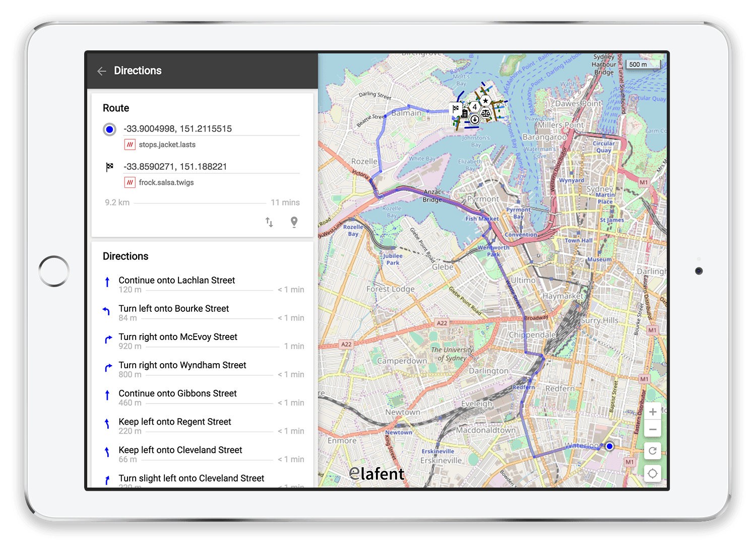
The screen below illustrates how public roads and private access tracks can be utilised to deliver optimised navigation and routing between assets, work orders and business centric POIs -
Business Impact
Delivering an optimal navigation and routing capability to the field can have a significant impact on improving operations and servicing customers and the community more effectively. Benefits include -
Improved quality of operational decision making
Reduced travel times
Increased efficiency
Reduced costs
Reduced number of devices required in the field
Reduced security issues
Less frustrated workers and customers!